沙坝至伊子:山间公路
Sa Pa · Muong Hum · Y Ty · Bat Xat · Lao Cai
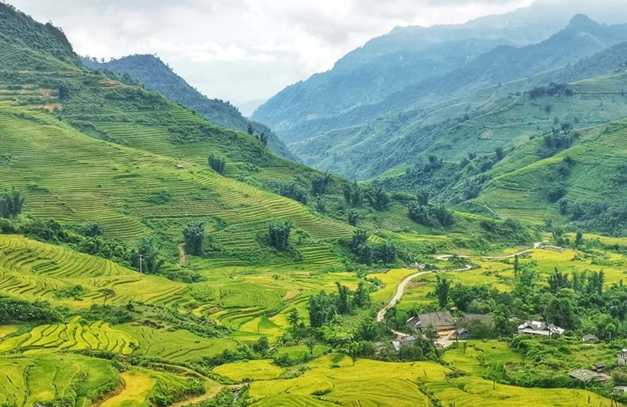
地区或交通示意照片,不代表承诺的停留点。 ©
Allow two riding days for this mountain link. Market villages and high views are the reward, but low cloud can turn a scenic stop into a reason to slow down and stay longer.
One road, and where it ends
This trip is essentially a single provincial road ridden end to end. Route 158 leaves route 156 at bản Vược, runs south-west through the Mường Vi valley and Bản Xèo to Mường Hum, turns north-west through Sàng Ma Sáo, Dền Sáng and Y Tý, then swings almost due north and finishes at the Lũng Pô junction in bản Tùng Sáng, where it meets route 156 again. That junction is the point of the whole thing. A Mú Sung is the northernmost commune in Lào Cai, and for about eighteen kilometres the border with China is not a line on a map but the Red River and the Lũng Pô stream themselves. Bản Lũng Pô is where the Red River crosses into Vietnam. Border marker 92 stands at the confluence, and a flagpole was raised beside it in December 2017 for the frontier guards of A Mú Sung. Ride the road the other way — from Lào Cai up the river and round — and you get the same country backwards; the district has trialled it in both directions since 2011.
Seventy per cent mountain
Bát Xát is 1,035.51 square kilometres with 74,388 people on it, which works out at seventy-two people to the square kilometre — empty, by Vietnamese standards. Over seventy per cent of it is mountain, fourteen peoples live in it and eighty-two per cent of the population belongs to an ethnic minority. The numbers that matter to a rider are the vertical ones: the lowest ground in the district is eighty-eight metres above the sea, the highest is 2,945, and the main ranges run from four hundred metres to 3,096 with average slopes of twenty to twenty-five degrees. The upland half — Y Tý, A Lù, A Mú Sung, Bản Xèo, Dền Sáng, Mường Hum, Sàng Ma Sáo and the rest — is 80,763 hectares, seventy-seven per cent of the district's land, and its climate is not tropical at all but sub-tropical and humid temperate. That is why the cloud sits where it does. On this road you are riding the weather boundary, not just the contour lines.
The Black Hà Nhì of Y Tý
The Hà Nhì are one of Vietnam's fifty-four peoples and one of the smaller ones: 25,539 at the 2019 census, most of them in Lai Châu, with about four thousand in Lào Cai. They speak a Lolo language of the Tibeto-Burman branch, and the group concentrated at Y Tý is the Black Hà Nhì. They are terrace-builders by tradition, and canal-and-dam builders with it, which is what the whole staircase of fields below the village is. Their houses are the thing you will notice first: rammed earth, walls built very thick, no windows at all, usually a single door set off-centre in the front, three bays inside and a wide veranda across the front of them. In the kitchen there is always a stone about forty centimetres high, Phu Chu Ma, the master of the hearth, dug out of ground nobody has walked on or lit a fire on and buried beside the cooking place; if the family moves, there is a ceremony to take the stone with them. The festival year runs Khu Già Già in the sixth lunar month and Ga Tho Tho in the eleventh, with the new-rice meals in between.
The peak that had the wrong name on it
Above Mường Hum stands Ky Quan San, 3,046 metres, the fourth-highest summit in Vietnam after Fansipan, Pu Si Lung and Pu Ta Leng, and the natural boundary between Mường Hum in Lào Cai and Sin Suối Hồ in Lai Châu. The French surveyors wrote the local name down as Ky Kouân Chan. People only started climbing it in 2013, and in 2014 a metal marker was carried up and set on the summit — inscribed Bạch Mộc Lương Tử, which is the name of a different thing. It stood there for five years before a marker with the correct name, Ky Quan San, was carried up to replace it in 2019. You will not be climbing it on this trip; the walk-in takes days, and from the Lào Cai side it starts with exactly the road you are riding, through the middle of Mường Hum to a staging point at Dền Sáng. But it is the wall on your left for most of the first day, and it is worth knowing what it is called.
How the two days work
Two riding days with a night at the top, and the night is the point. Day one climbs out of Sa Pa, drops onto route 158 at Bản Xèo and works north-west through Mường Hum, Sàng Ma Sáo and Dền Sáng to Y Tý — about seventy kilometres that take most of a day because of what the road does, not because of the distance. Day two runs north to the Lũng Pô junction and then down the Red River through Bát Xát to Lào Cai, which is long but easy. Stay in Y Tý rather than pushing through: cloud sits on that shoulder for most of the year, the village clears in the early morning more often than in the afternoon, and the reason to be there is what the light does to the terraces at dawn. Two notes. Accommodation is limited and worth confirming before you commit to the night. And the administrative map moved under everyone's feet on 16 June 2025: A Lù was merged into Y Tý, Nậm Pung and Trung Lèng Hồ into Mường Hum, Nậm Chạc into A Mú Sung, and on 1 July Lào Cai province absorbed Yên Bái. The road signs still say what they said.
这段旅程由我们亲自带队。
向导来自我们的团队,路线我们亲自骑过,整个行程您只需与我们一个对话。
- 来自我们团队的向导
- 我们亲自骑过的路线
- 我们在 5 座城市设有维修点,另有合作维修站
- 整个行程只需与我们一个对话
- 16
- 座城市
- 24
- 条旅行线路
- 71
- 条路线
- 6
- 家维修点