Quy Nhon to Tuy Hoa: fishing coast
Quy Nhon · Song Cau · O Loan · Tuy Hoa
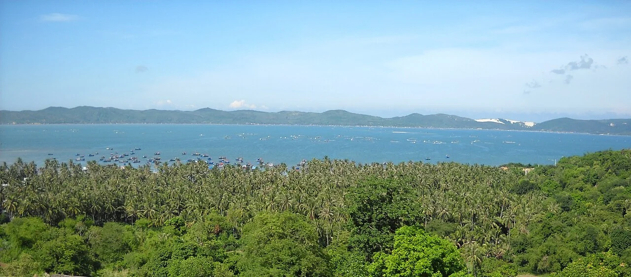
Illustrative regional or transport photo; not a promised stop. ©
Connect two coastal bases in a leisurely day, taking established coastal roads where practical. The villages between the cities are the point of the journey, not just places to refuel.
Two provinces that no longer exist
This ride starts in what everyone still calls Bình Định and ends in what everyone still calls Phú Yên, and neither province is on the map any more. In 2025 Bình Định was merged into Gia Lai and Phú Yên into Đắk Lắk, so the road now runs from one highland province to another without ever leaving the sea. The old boundary is still where it always was: the Cù Mông pass, which from 1471 until 1611 was the border between Đại Việt and Champa. Signs, addresses and conversation have not caught up, and nobody on this coast will correct you for saying Phú Yên. What matters on the bike is simpler: about 130 kilometres of coast road with two lagoons, one deep bay, a mountain pass and a string of fishing villages that are the reason to take the whole day over it rather than the four hours it can be ridden in.
The pass, and the way round it
Cù Mông is a spur of the southern Trường Sơn running into the sea, and Highway 1 climbs over it: seven kilometres of road between km 1239 and km 1247+470, a summit at 245 metres and a gradient of nine per cent, with tight bends and high ground on both sides. It has a long-standing reputation as one of the more dangerous passes in the country, which is why the Cù Mông tunnel was built — 2.6 kilometres of bore in a six-and-a-half kilometre scheme, two tubes, opened on 21 January 2019 — and why most of the lorries now go under the mountain instead of over it. Two-wheelers are not the tunnel's business, and that is the good news: the old road over the top is emptier than it has been for decades. Take it slowly, use the engine on the way down, and stop at the top where there is room to pull off, not on a bend.
Xuân Đài
Beyond the pass the road drops to the first of the water. Xuân Đài is a bay of 130.45 square kilometres, closed off by the Cổ Ngựa range, which runs some fifteen kilometres out to sea as the Xuân Thịnh peninsula and wraps around both the bay and the Cù Mông lagoon behind it. The classic view is from the top of the Găng slope on Highway 1, where the whole thing opens at once: a ring of hills, a shore under coconut palms, and the small bays of Vũng La, Vũng Sứ and Vũng Chào inside it. This was a strategic anchorage long before it was scenery. The commanders who held Phú Yên for the Nguyễn lords — Văn Phong, then Nguyễn Phúc Vinh — had their headquarters here; in 1775 Tống Phước Hiệp threw the whole Nguyễn army at the Tây Sơn holding the bay; in April 1945 a Japanese naval force came in and was burned by Allied aircraft. The bay was listed as a national monument in 2011.
Sông Cầu, which used to be the capital
The name Sông Cầu first appears in 1611, in the district of Đồng Xuân in the prefecture of Trấn Biên. Under the French it was the seat of Phú Yên province twice over: at Vũng Lắm in 1888–1889 and then at Long Bình from 1899 to 1945, which is why a small coastal town has a royal pagoda and photographs of Bảo Đại arriving on an official visit in 1933. It lost the capital to Tuy Hòa and kept the coast: eighty-nine kilometres of it, the longest stretch of any district in the old province, with the Xuân Thịnh and Xuân Hải peninsulas and beaches at Vịnh Hòa, Bãi Tràm and Bãi Bàu. Just offshore lies Nhất Tự Sơn, a wooded islet reached on foot along a stone spit when the tide is out. The water is also the town's industry: this is a lobster and crab coast, farmed in the Cù Mông lagoon and in Xuân Đài bay, and the seafood is why people stop here on the way south.
Ô Loan and the plain
The second lagoon comes at the foot of the Quán Cau slope. Ô Loan is brackish, more than 17.5 square kilometres of it, a metre and a half deep on average and up to three in the rains, fed by the Sông Cái and joined to the sea by one narrow channel, with the Đồng Cháy and Cẩm hills and the An Hải dune around it. It was listed as a national scenic site on 27 September 1996; on the seventh day of the first lunar month the villages race boats on it; and it is known across Vietnam for blood cockles, which are said to be sweeter here than anywhere else. It is also under pressure — dyked ponds and pollution from aquaculture — and that is visible from the road. South of it the land opens out into the Tuy Hòa plain, the largest coastal plain in the south-central region, laid down by the Đà Rằng river, and the ride ends by crossing it on the long bridge into town.
We lead this ride ourselves.
The guide is from our team, the route is one we have ridden, and you have one chat with us for the whole trip.
- Guides from our team
- Routes we have ridden ourselves
- Our workshop in five cities and partner workshops
- One chat with us for the whole trip
- 16
- cities
- 24
- tours
- 71
- routes
- 6
- workshops