Mui Ne a Ca Na: costa de dunas
Mui Ne · Bau Trang · Phan Ri · Ca Na
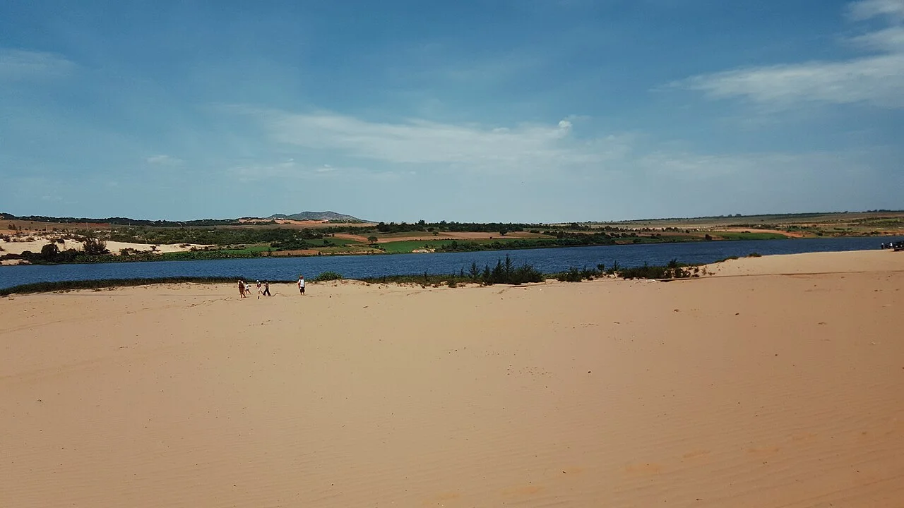
Foto de región o transporte, no una parada prometida. ©
Follow the changing coastline north for a one-way day. Fishing settlements and open dune country deserve pauses, with a night at the coast before continuing towards Phan Rang.
Two provinces that were not there last year
This is a hundred and twenty kilometres of coast that has been re-labelled three times in fifty years. In 1976 Ninh Thuận, Bình Thuận and Bình Tuy were welded into one province called Thuận Hải; in the 1990s they were separated again; and on 12 June 2025 they were cut up once more along a completely different line. Bình Thuận went into Lâm Đồng, so Mũi Né and its dunes are now administratively part of the province whose capital is Đà Lạt. Ninh Thuận went into Khánh Hòa, so Cà Ná now belongs to the province of Nha Trang, 135 kilometres up the coast. The border between them falls between Vĩnh Hảo, the easternmost commune of Lâm Đồng, and Cà Ná, the southernmost of Khánh Hòa, and you will cross it without noticing anything but a sign.
A freshwater lake inside a desert
Twenty-five kilometres north-east of Mũi Né the dunes open onto something that should not be there: a freshwater lake, sixty-two kilometres from Phan Thiết, in the middle of sand. Bàu Trắng is really two lakes — the locals call them Bàu Ông and Bàu Bà, the male and the female — separated by a sand ridge that people are said to have built across a single larger lake in order to cross it. Bàu Bà is the bigger and the deeper, nineteen metres in the rainy season, and its surface is planted with lotus, grown for the seeds and the young shoots. The poet Nguyễn Thông gave it a second name in the nineteenth century, Bạch Hồ, the white lake, and that is the one the literary tradition kept. On its southern side there is a shrine to the goddess Yana, whom the Chăm credit with bringing water here to people and to the animals of the forest through the dry season, which on this coast is most of the year.
The fastest empty road on the coast
From the Bàu Trắng junction there is a road that most people driving between Phan Thiết and the north have never used. Provincial road 716B, the Bàu Trắng – Phan Rí Cửa coast road, runs twenty-five kilometres across open sand country to the Thống Nhất crossroads in Phan Rí Cửa, and it is more than twenty kilometres shorter than going round by Highway 1. It was built wide: six lanes, four of them for cars and two set aside for two-wheelers, with a ninety-kilometre limit for cars and sixty for bikes. The result is an almost empty piece of engineering laid across a desert, which is either the best half-hour of this ride or a serious temptation, depending on how you handle it. The wind is the thing to respect here: this is where Vietnam's first wind farm was built in 2012, at Bình Thạnh in Tuy Phong, and the turbines are on the skyline for the rest of the day.
Stone, water and salt
The second half of the ride is a list of things this dry coast makes. At Cổ Thạch, a hermitage founded in 1835 by the monk Bảo Tạng has grown into a complex of halls and caves over four hectares of a sixty-four-metre rock hill, a national monument since 1993, with twenty-three old Buddha images in the Tam Bảo cave and a bell and a thunder drum from the first half of the nineteenth century; below it the Cà Dược shingle runs along the shore, the stones that visitors call the seven-colour beach, and in the middle of March they go green under moss. At Vĩnh Hảo a mineral spring has been drunk since the Chăm used it medicinally; the story is that it cured the king Chế Mân in the thirteenth century and that princess Huyền Trân, his queen, named it Vĩnh Hảo — forever good — and the French were bottling it by 1920. And at the end, Cà Ná: salt. The old province of Ninh Thuận has three of the country's seven great salt fields and produces about half of all the salt in Vietnam.
How the day works
A hundred and twenty kilometres, one way, and almost no climbing — but it is the hottest and most exposed day in this set of guides. Leave Mũi Né early; the dune road to Bàu Trắng is at its best before nine and unbearable at noon. Fuel before you turn onto 716B and again at Phan Rí Cửa. Carry more water than seems sensible, because between the dunes and Liên Hương there is very little shade and almost nothing to buy. The wind blows hardest in the afternoon, which is when the sand starts moving across the tarmac in the dune sections, so aim to be past Phan Rí Cửa by lunchtime. Sleep at Cà Ná or at Cổ Thạch rather than turning round: the same road back into a head wind and a low sun is a much longer afternoon than the map suggests.
Este viaje lo guiamos nosotros mismos.
El guía es de nuestro equipo, la ruta la hemos recorrido nosotros y tienes un solo chat con nosotros durante todo el viaje.
- Guías de nuestro equipo
- Rutas que hemos recorrido nosotros mismos
- Nuestro taller en 5 ciudades y talleres asociados
- Un solo chat con nosotros durante todo el viaje
- 16
- ciudades
- 24
- tours
- 71
- rutas
- 6
- talleres