Mu Cang Chai: fin de semana entre arrozales
Nghia Lo · Tu Le · Khau Pha · Mu Cang Chai
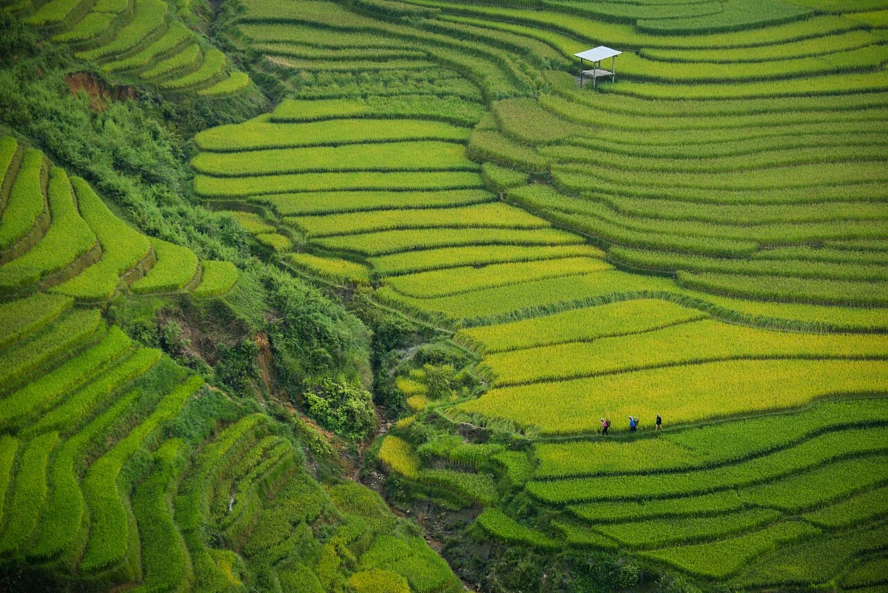
Foto de región o transporte, no una parada prometida. ©
Ride the long approach in two stages, using Tu Le for a pause before the pass. Arriving early at the terraces leaves time for a walk and avoids pushing into evening mountain traffic.
A landscape made by hand
Mù Cang Chải is a district of steep valleys in the Hoàng Liên Sơn foothills, a thousand metres up and a long way from anywhere, where about nine in ten people are Hmong. It is famous for one thing: the terraces. Over generations, without machines, Hmong families cut the hillsides of La Pán Tẩn, Chế Cu Nha and Dế Xu Phình into thousands of narrow steps, each one levelled, walled with earth and fed by a channel from the stream above, so that a single crop of rice a year could be grown on slopes that would otherwise hold nothing. The terraces cover some 2,200 hectares; the finest 330 hectares were listed as a national scenic monument in 2007, and in 2019 the landscape was raised to a special national monument — a working farmland treated as heritage. That is the thing to hold in mind on the road: what you are looking at is not a view but a working system of fields, and every step of it is somebody’s.
The pass called Horn of Heaven
The way in from the east is over Khau Phạ, whose name in Thái means something like ‘horn of heaven’ — a pass of about thirty kilometres on National Highway 32 between the Tú Lệ valley and Cao Phạ, climbing to roughly 1,200 metres through cloud that sits in the col most mornings. Vietnamese riders count it among the four great passes of the north with Mã Pí Lèng, Ô Quy Hồ and Pha Đin, and it is the gentlest of the four: long, wide, well surfaced, with a viewpoint at the top where paragliders launch over the golden terraces of Lìm Mông in September and October in a festival called ‘Flying over the golden season’. The road was rebuilt in the 2000s; before that the district was reached by a track that closed for weeks in the rains. It is still the only paved way in from Hanoi, and everything — rice, fuel, tourists — comes over it.
Two valleys of rice on the way
The ride starts in the flat Mường Lò basin at Nghĩa Lộ, which the old rhyme of the north-west ranks second among its rice fields — ‘first Thanh, second Lò, third Than, fourth Tấc’ — and which belongs to the Thái people, whose stilt houses stand on the edge of the paddies and whose circle dance, xòe, was inscribed by UNESCO in 2021. Forty-odd kilometres on, the road drops into Tú Lệ, a small valley closed by mountains where the sticky rice is reckoned the best in the country: the local nếp Tú Lệ, grown on the cool valley floor and, in September, cut green and pounded into cốm, the flat jade-coloured flakes that are sold warm in banana leaf at the roadside. Both are stops, not just towns to pass. The Thái and the Hmong here are different peoples with different houses, dress, food and calendars, and the weekend runs from one to the other.
The golden month
The terraces are photographed in two seasons and worked in all of them. In May and June the channels are opened and the steps fill with water, mirroring the sky — the ‘pouring water’ season, when the fields are ploughed with buffalo and planted by hand. Through July and August they are green. From about the middle of September to the middle of October the rice ripens from the valley floor upwards and the slopes go yellow, then gold, then are cut — the season everyone comes for, when the district holds its terrace festival and the homestays of La Pán Tẩn are booked weeks ahead. After the harvest the steps are brown stubble until spring. There is no second crop: the altitude and the cold do not allow it, and in the dry months the fields are grazed or left. Plan the weekend around the calendar, and expect to share the road in the golden weeks.
Why two days, and why from Nghĩa Lộ
Mù Cang Chải is about three hundred kilometres from Hanoi, too far for the terraces to be a day. We start the ride at Nghĩa Lộ, a comfortable night’s stop with fuel, mechanics and the Thái food of Mường Lò, and give the weekend a hundred kilometres each way on Highway 32: up through Tú Lệ, over Khau Phạ, and down to Mù Cang Chải town on the first day, with the afternoon on the side roads into La Pán Tẩn; the second morning on the terraces again in the early light, and the ride back over the pass before the afternoon cloud. The side roads are the point and the problem: the concrete lanes up to Mâm Xôi hill and the Chế Cu Nha viewpoints are steep, single-track and shared with everything the villages own, and in the golden weeks the district closes some of them to cars. Ride them slowly, park where the locals park, and remember that the field you want to stand in belongs to the family whose house you are photographing. Since July 2025 the district belongs to the enlarged Lào Cai province; the signs still say Yên Bái.
Este viaje lo guiamos nosotros mismos.
El guía es de nuestro equipo, la ruta la hemos recorrido nosotros y tienes un solo chat con nosotros durante todo el viaje.
- Guías de nuestro equipo
- Rutas que hemos recorrido nosotros mismos
- Nuestro taller en 5 ciudades y talleres asociados
- Un solo chat con nosotros durante todo el viaje
- 16
- ciudades
- 24
- tours
- 71
- rutas
- 6
- talleres