Mai Chau a Pu Luong: un fin de semana en los valles
Mai Chau · Co Luong · Pu Luong · Mai Chau
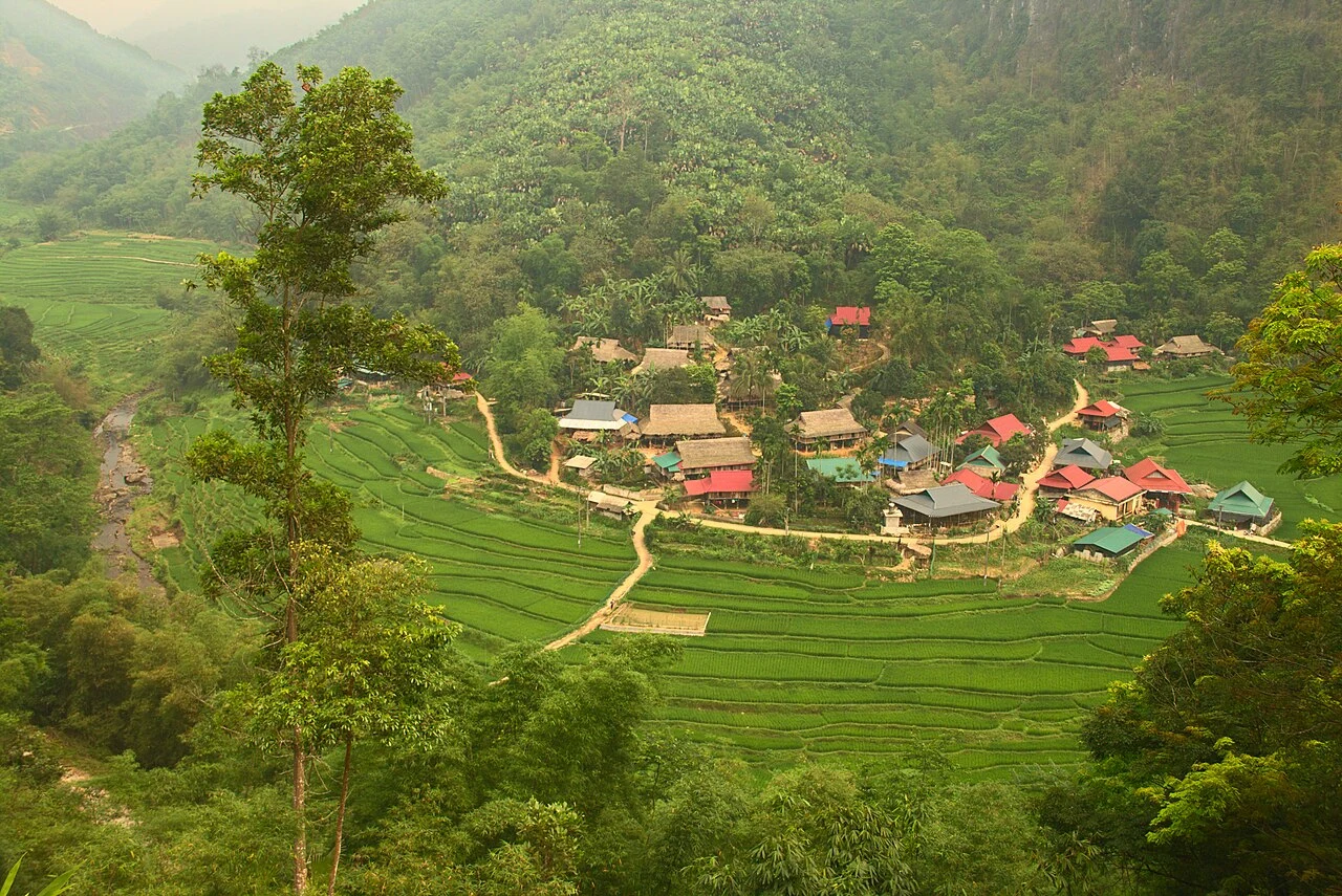
Foto de región o transporte, no una parada prometida. ©
Give each valley a night. Rice fields, stilt-house villages and shaded lunch stops make the link between them part of the experience rather than a transfer to endure.
Two valleys, one limestone, two provinces
This is a weekend between two flat-bottomed valleys held apart by the same limestone. Mai Châu lies in a bowl between vertical walls of it, on Highway 15, about 135 kilometres from Hanoi; the commune covers 147.74 square kilometres and holds 19,143 people. Fifty kilometres south, over the watershed, Pù Luông is a commune of 81.71 square kilometres and 9,573 people and Cổ Lũng beside it is 127.05 square kilometres and 9,726 — seventy-seven people to the square kilometre, which is what empty looks like on a map. Both ends were redrawn in June 2025. Mai Châu is now part of a Phú Thọ that swallowed Hòa Bình and Vĩnh Phúc whole; Pù Luông and Cổ Lũng became communes of Thanh Hóa when the district of Bá Thước was dissolved. Nobody on the ground says any of this. The valley people still call the country by the old names, and the limestone ridges, which run unbroken from one valley to the other, were not consulted.
The white pass
The way in from Hanoi comes over Thung Khe, which everybody calls the White Rock pass. It sits on Highway 6 on the boundary between Phú Cường and Thành Sơn, about twelve kilometres from the Tòng Đậu junction where Highway 15 turns off towards Mai Châu, and eighteen from the town of Mãn Đức the other way. In certain weather the cloud lies white across the whole pass with gaps in it, and you look down through the gaps into the valley; that is where the second name comes from. The road itself is younger than it looks. When the Hòa Bình dam was completed in 1994 it drowned the old Route 6, and this stretch — from Hòa Bình town up to the Lũng Bon junction in Sơn La — was cut new. Stop at the top. There is a row of stalls selling maize and sticky rice, the temperature is ten degrees below what it was an hour ago, and the whole of Mai Châu is laid out underneath.
Bản Lác and the Thai valley
Mai Châu's people are mostly Thái, with Kinh and Mường alongside them, and it is the Thái culture that shapes what you see. The stilt house is the obvious part: a raised timber floor, an open room with no internal walls, a ladder at one end. Less obvious is everything else — the dialect, the xòe circle dance, nhảy sạp danced between clapping bamboo poles, the piêu headscarf, the brocade that the weaving villages here still produce on floor looms. The best known village is bản Lác, which is given an age of more than seven hundred years and which is now, frankly, a place that lives on visitors: two rows of stilt houses turned into guest houses, stalls under them, and a performance most evenings. That is not a reason to avoid it. It is a reason to sleep there one night and spend the other nights somewhere quieter, and to walk out of it in the morning into the fields, where the valley returns to what it is the rest of the time.
Pù Luông means big mountain
The Thái name says it plainly. The reserve was declared in 1999 and covers 17,662 hectares, of which 13,320 are strictly protected and 4,343 are under ecological restoration, and with Pù Hu it does the watershed work for the upper Sông Mã. It sits twenty-five kilometres from Cúc Phương and is joined to the tail of that national park by two parallel limestone ranges with rice valleys running between them — which is exactly the landscape you ride through. Five forest types stack up by height, from lowland broadleaf on limestone at sixty metres to broadleaf on basalt at 1,650. Surveys have recorded 84 mammals including 24 bats, 162 birds, 55 fish, 28 reptiles and 13 amphibians, at least 158 butterflies, and 96 land molluscs of which a dozen may be found nowhere else. Clouded leopard, Asian golden cat, sika deer, Asiatic black bear, serow and the Delacour's langur are all on the list. You will see none of them. What you will see is terraced rice on gentle slopes, water wheels, and karst going up into cloud.
How the weekend works
Three days, two nights, about a hundred and fifty kilometres, and the riding is the least of it. Day one is Mai Châu: up to the pass in the morning for the view, back down, and the afternoon on foot in the valley. Day two is the crossing — south on Highway 15 down the valley to the Mã river at Co Lương, then east into the reserve on small roads, which is three or four hours of genuinely slow riding and the best part of the trip. Sleep in the Pù Luông valley. Day three is the loop out through Cổ Lũng and back north. Two practical things decide it. The roads inside the reserve are narrow, steep in short pitches and often wet from springs, so plan half the daily distance you would plan on a highway. And beds are limited: book before you ride, because arriving at dusk in a valley with two guest houses and no signal is a bad way to end a good day. Kho Mường is the one detour worth making even if it costs you an hour.
Este viaje lo guiamos nosotros mismos.
El guía es de nuestro equipo, la ruta la hemos recorrido nosotros y tienes un solo chat con nosotros durante todo el viaje.
- Guías de nuestro equipo
- Rutas que hemos recorrido nosotros mismos
- Nuestro taller en 5 ciudades y talleres asociados
- Un solo chat con nosotros durante todo el viaje
- 16
- ciudades
- 24
- tours
- 71
- rutas
- 6
- talleres