昆嵩至芒登:清凉高地
Kon Tum · Mang Den · pine roads
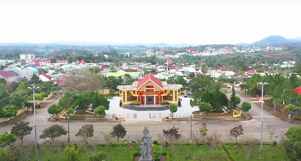
地区或交通示意照片,不代表承诺的停留点。 ©
Climb gradually out of the warmer river town and give Mang Den an overnight stay. The quieter pine roads suit a short next-morning outing before continuing or returning.
Sixty kilometres and six hundred metres
Măng Đen is sixty kilometres north-east of Kon Tum and about six hundred metres above it, and the whole ride is the business of getting up there. The road is Highway 24, which runs 170 kilometres from the Thạch Trụ crossroads on Highway 1 near the coast to Kon Tum, and which has two serious passes on it: Vi Ô Lắc at the Quảng Ngãi end and Măng Đen at this one. The Măng Đen climb was rebuilt. A new twelve-kilometre alignment opened in 2015, running along the north side of the old road to avoid the town of Đắk Rve, with fewer bends and a gentler gradient, and most of the old pass road is now the main street of Măng Đen itself. A further 31.3 kilometres was upgraded in 2022, cut through the hillsides to take out the hairpins. The rest is coming: in April 2026 the province approved the upgrading of 48 kilometres more, from Km32 to Km89+513, to mountain road class III and IV with a nine-metre formation, at a cost of about 2,350 billion đồng, to be built between 2026 and 2028. Which is to say: expect roadworks, and check before you go.
T'măng Deeng, the flat wide place
The name is Mơ Nâm. T'măng Deeng means a flat and spacious piece of ground, which is what the plateau is once you are on top of it: not a summit but a broad shelf at about 1,200 metres, with the mountains going on up behind it to Ngok Krinh at 2,066 metres. The commune covers 396.93 square kilometres and holds 9,438 people — twenty-three to the square kilometre, which is close to empty. The climate up here is not the climate of the lowland highlands; it is temperate and cool all year, close enough to the Lâm Viên plateau above Đà Lạt that people grow the same cold-weather vegetables, fruit and medicinal plants. The French noticed this early in the twentieth century. They came up, surveyed, planted pines and intended to build a hill station, and although the hill station never happened the pines did: the plantations are still the thing you ride through. Măng Đen gets called the second Đà Lạt often enough that the phrase has stopped meaning much, but the comparison is not wrong.
Old rock under young basalt
Underneath, this is some of the oldest ground in the country. The basement here formed in the Precambrian, roughly 2,500 million years ago; at the end of the Tertiary the plateau felt the shock of the Himalayan folding; in the Quaternary basalt flowed out over it while the Ngọc Linh and Pleiku blocks settled around it. Geologically Măng Đen is not part of the Ngọc Linh massif at all — it is the north-eastern tail of the Pleiku plateau, the same red basalt shelf that Pleiku and Kon Tum sit on, lifted higher. What that gives you on the ground is low rolling hills of deep red soil, high humidity, primary forest that survived because nobody could farm it, and water everywhere: streams, lakes and a set of waterfalls within a few kilometres of the town. Pa Sỹ is the one people ride to; Đăk Ke is a lake and a fall together, ten minutes from the main street, and in the blossom season the whole shore of it turns pink.
The Madonna without hands
Beside Highway 24, fifty-three kilometres out from Kon Tum, stands a statue of Our Lady of Fatima with no arms, and it is the strangest thing on this road. Father Giuse Nguyễn Minh Kông brought it up to the Măng Đen military outpost by helicopter and set it on a plain pillar in the middle of 1971. In 1974 the outpost was destroyed in the fighting, the statue was damaged, and the forest closed over it. Settlers from the Măng Cành forestry farm found it again in the early 1980s and nobody took much interest. It was still whole at the beginning of 1987; by the end of that year the head and the hands were gone, and nobody knows why. When Highway 24 was surveyed through here in 2004 the road builders saw the design would pass over it and moved the line. One of them, a Catholic named Hoàng, restored the head — and the face he made is not the usual Fatima face but the face of a Central Highlands woman. The hands could not be done; what he attached fell off at the statue's feet. A bishop came on 28 December 2006, a Mass for more than two thousand people followed on 9 December 2007, and 9 December has been the diocese's pilgrimage day ever since.
How the ride works
Treat this as two half-days with a night in between, not as a transfer. Leave Kon Tum after breakfast, take the forty kilometres of valley road east at whatever pace the roadworks allow, and give the pass its own hour: twelve kilometres of new alignment with the old road visible below and the temperature dropping the whole way. Arrive in the early afternoon, find your bed, and spend what is left of the day on the town's own circle — the lake, the pagoda, the Madonna, the village at the far end. Keep the pine roads for the next morning, when the fog is still in them. Two things to plan for. It is genuinely cold here after dark by Vietnamese standards, and almost nobody arrives dressed for it. And the mist comes down on the pass without warning at both ends of the day, which is the single good reason not to ride this road at dusk.
这段旅程由我们亲自带队。
向导来自我们的团队,路线我们亲自骑过,整个行程您只需与我们一个对话。
- 来自我们团队的向导
- 我们亲自骑过的路线
- 我们在 5 座城市设有维修点,另有合作维修站
- 整个行程只需与我们一个对话
- 16
- 座城市
- 24
- 条旅行线路
- 71
- 条路线
- 6
- 家维修点