De Da Lat a la costa
Da Lat · Khanh Le pass · Nha Trang
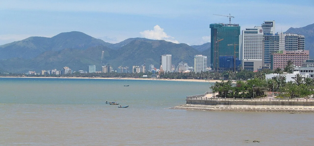
Foto de región o transporte, no una parada prometida. ©
A single day crosses from cool plateau air to the coast. Stop before the descent to rest and add a night in Nha Trang rather than trying to return uphill the same evening.
A road built on purpose
Most mountain roads in Vietnam grew out of something older. This one was built to do a job. Work started on 20 April 2004 on 121 kilometres of new road from Highway 1 at Diên Khánh up to Highway 20 on the plateau, phase one opened on 24 July 2007, and in June 2015 the two provincial roads it had replaced — 652 on the Khánh Hòa side, 723 on the Lâm Đồng side — were promoted into a single national highway, 27C. Vietnamese travel writing calls it the road that joins the sea and the flowers, which is unusually accurate for a nickname: at one end are the vegetable and flower farms of a plateau at 1,500 metres, at the other a beach city, and the road exists so that the first can reach the second in a morning. The last piece arrived on 10 February 2018, when the ten kilometres of Võ Nguyên Giáp avenue opened and took the highway straight into Nha Trang instead of round through Diên Khánh.
The pass with five names
The descent has as many names as it has users. The signboards call it the Khánh Lê pass. Riders call it Omega, for the shape it draws on the map; others call it the Hòn Giao pass after the mountain beside it, or the Bidoup pass after the national park, or the Long Lanh pass after K'Long K'Lanh, the K'Ho village at its foot on the plateau side. The summit is 1,700 metres, exactly on the boundary between Nam Khánh Vĩnh in Khánh Hòa and Lạc Dương in Lâm Đồng. It is frequently sold as the longest pass in Vietnam, and it is not: Ô Quy Hồ in the far north is nearly fifty kilometres, and this one is either 29 kilometres, as the sign at the Khánh Vĩnh foot says, or 33 by other accounts. What is true is the rest of it — sharp bends, rock walls, drops of up to 300 metres beside the tarmac, and cloud that sits on the road until about eight in the morning and comes back down at three or four in the afternoon.
The roof of the Central Highlands
For an hour either side of the summit you are inside Bidoup – Núi Bà, which Vietnamese sources call the roof of the Central Highlands. The park was created in 2004 and named after the two highest peaks of the Lâm Viên plateau, Bidoup at 2,287 metres and Núi Bà at 2,167; it covers 64,800 hectares, of which 28,731 are strictly protected, and in 2015 it became part of the Langbiang biosphere reserve recognised by UNESCO. The numbers behind the trees are worth knowing while you ride past them: more than 1,933 vascular plant species with 96 endemics and 62 on the IUCN red list, fourteen of Vietnam's thirty-three conifer species including the two-needle flat pine that botanists treat as a living fossil, and 441 vertebrates of which 32 are red-listed. Bidoup means the man lying down in Cơ Ho. In the story the mountain was a nephew who kept growing until his aunt told him to lie down before he touched the sky.
Whose mountains these are
The people of this plateau are Cơ Ho, and the divisions matter: the Srê are the wet-rice group of the Di Linh plateau, the Chil live high and weave, the Lạch gave their stream Đạ Lạch the name that became Đà Lạt. Villages are called bòn and were built as rows of long houses by clan, matrilineal, under a headman whose authority came from being the oldest rather than the richest, since the difference between households was a gong or a jar rather than land. The commune you cross is called Lạc Dương, and it is the largest in the province: 828 square kilometres and 14,912 people, eighteen to the square kilometre, assembled on 16 June 2025 out of Đạ Nhim, Đạ Chais and Đạ Sar. Four days earlier, Lâm Đồng itself had absorbed Bình Thuận and Đắk Nông, which makes the province you start in one of the largest in the country and the signs slightly newer than the maps.
How the day works
A hundred and forty kilometres, one way, and fifteen hundred metres of altitude given away in a single afternoon. Start late rather than early: leaving Đà Lạt at eight puts you on the pass while the cloud is still on it, and there is nothing to see and everything to hit. Fuel in Lạc Dương, because the pass itself has no services at all, and eat before you start down — the next real town is Khánh Vĩnh, an hour and a half away. Dress for both ends of the road: it can be sixteen degrees at the summit and thirty at the bottom, and the temperature changes faster than you can stop and unpack. Above all, do not plan to come back up the same evening. This route is a one-way day by design, the second half of it is a descent you should ride rested, and the sensible plan is a night at the coast and the climb back another morning.
Este viaje lo guiamos nosotros mismos.
El guía es de nuestro equipo, la ruta la hemos recorrido nosotros y tienes un solo chat con nosotros durante todo el viaje.
- Guías de nuestro equipo
- Rutas que hemos recorrido nosotros mismos
- Nuestro taller en 5 ciudades y talleres asociados
- Un solo chat con nosotros durante todo el viaje
- 16
- ciudades
- 24
- tours
- 71
- rutas
- 6
- talleres