高平与板约:喀斯特山水
Cao Bang · Quang Uyen · Trung Khanh · Ban Gioc · Cao Bang
地区或交通示意照片,不代表承诺的停留点。 ©
Make this a two-day outing rather than a hurried waterfall dash. Sleep near Trung Khanh so the falls and surrounding valleys have their own morning.
The other geopark
Cao Bằng is the far north-east: a province of limestone valleys wedged against the Chinese border, three hundred kilometres from Hanoi and until recently a long way off any tourist route. In April 2018 UNESCO recognised more than three thousand square kilometres of it as the Non Nước Cao Bằng Global Geopark, Vietnam’s second after Đồng Văn, for rock that records some five hundred million years — old marine limestone folded into cones and towers, rivers that vanish underground and reappear, and the lakes, caves and waterfalls that result. Where Hà Giang’s plateau is bare grey stone, Cao Bằng is green: the karst here stands in wet valleys of rice and maize, with rivers running clear between the towers. The people are mostly Tày and Nùng, the two related lowland groups who build stilt houses and terrace the valley floors, with Hmong, Dao, Lô Lô and Sán Chỉ in the hills above them; the Kinh are a minority outside the city. The roads are quiet, the passes are moderate and the distances are honest, which makes this the easiest of the northern border rides to do well.
A waterfall with a border through it
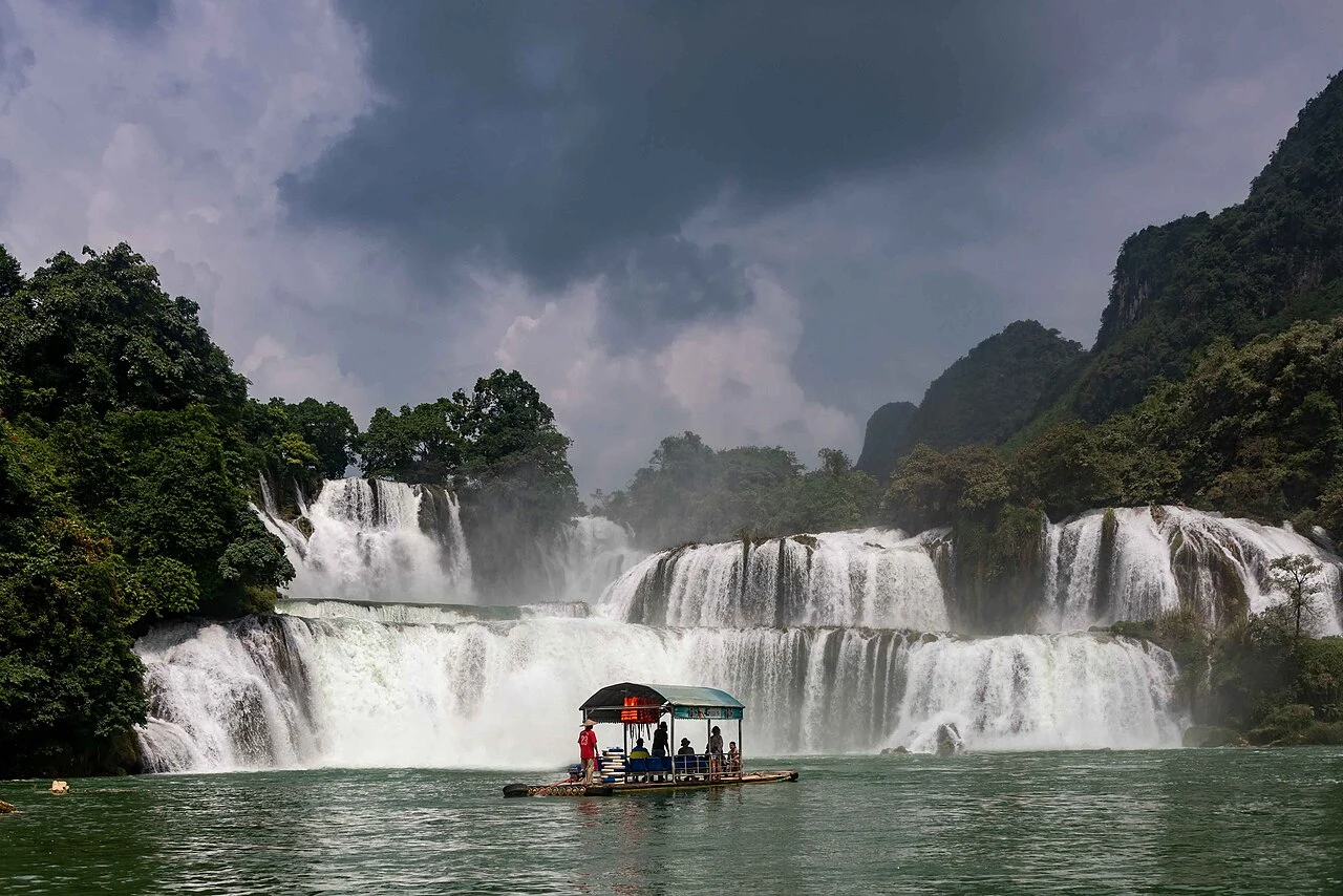
Bản Giốc is the reason most people come. The Quây Sơn river, which rises in China, loops through Vietnam and forms the border for a stretch, drops here over a series of limestone steps about thirty metres high and, counting both parts, some two hundred metres wide, split by an island into a broad lower fall and a taller, narrower upper one. The frontier runs down the middle of the river: the Vietnamese bank calls it Bản Giốc, the Chinese bank calls it Detian, and it is reckoned the fourth largest waterfall on a national border in the world after Iguazú, Victoria and Niagara. The line was settled by the 1999 land-border treaty and only fixed at the falls themselves in 2008, after decades of dispute — which is why the falls stayed hard to reach for so long. Bamboo rafts pole out under the spray from both banks; the Vietnamese ones leave from a jetty below the ticket gate. Come in the rainy season, from June to September, when the river is full and brown-gold; by the dry months of spring the fall has shrunk to threads.
Blacksmiths, incense and a cave of tigers
The road east from the city climbs the seven tiers of the Mã Phục pass and drops into the Quảng Uyên valley, home of the Nùng An, who have been forging iron for as long as anyone can say. In the village of Phúc Sen, families beat knives, sickles and cleavers from truck springs over charcoal in open sheds beside the road; you can watch, buy, and hear the hammers from the highway. A few kilometres on, at Phia Thắp, the same people make incense sticks by hand and dry them in fans on the ground. Then Trùng Khánh, the market town under the chestnut hills, and beyond it the falls. Five kilometres from Bản Giốc the Ngườm Ngao cave — ‘tiger cave’ in Tày — runs more than two kilometres into the hill, discovered in 1921 and opened to visitors in 1996, with a lit path of about a kilometre through chambers of stalactites the colour of gold. It is the cool hour of the second morning, and the least crowded thing on the route.
The cave where the revolution came home
Cao Bằng has a second kind of history. In January 1941, after thirty years abroad, Hồ Chí Minh walked across the border from China at Pác Bó, fifty kilometres north-west of the city, and lived for seven weeks in a small cave above a stream he named after Lenin, beneath a hill he named after Karl Marx, writing and organising the movement that would declare independence four years later. The site is a national monument: the cave, the stream — genuinely turquoise — the stone table where he worked, and the marker for kilometre zero of the Hồ Chí Minh road, which now runs the length of the country. It is not on the waterfall loop, but it is a half-day from the city and the road there, through the valleys towards Hà Quảng, is one of the prettiest in the province. If you have a third morning, this is what to do with it.
Why two days, and which way round
The falls are ninety kilometres from the city — two and a half hours of riding — and most visitors do them as a day trip: out in the morning, an hour at the water, back by dark. We split it. Day one goes east over Mã Phục, stops at the blacksmiths and the incense village, and ends at a homestay at Trùng Khánh or on the river below the falls, so that the second morning starts at the cave and the waterfall before the buses arrive from the city at eleven. The return on day two takes the northern road through Trà Lĩnh, past the Thang Hen lakes and the mountain with a hole through it that the Tày call the Eye of God, and drops back into the city from the north — a loop of about two hundred kilometres with no road ridden twice. Everything on it is within a few kilometres of the border: use the signed approaches, carry your passport, and do not follow tracks towards the frontier posts. The province was not merged in the 2025 reforms; Cao Bằng is still Cao Bằng.
这段旅程由我们亲自带队。
向导来自我们的团队,路线我们亲自骑过,整个行程您只需与我们一个对话。
- 来自我们团队的向导
- 我们亲自骑过的路线
- 我们在 5 座城市设有维修点,另有合作维修站
- 整个行程只需与我们一个对话
- 16
- 座城市
- 24
- 条旅行线路
- 71
- 条路线
- 6
- 家维修点